Construct a Down-Plunge Profile
Steven Dutch, Professor Emeritus, Natural and Applied Sciences, University of Wisconsin - Green Bay
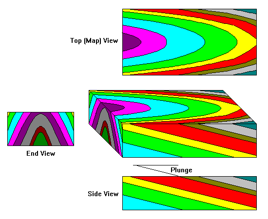
The above diagram shows a block model of a fold with top, side and end views (the traditional cross-section). We can see that both the traditional cross-section and the map view are oblique to the axis of the fold. Both are actually oblique cross-sections. If the plunge were 45 degrees, both views would look the same. When the plunge is less than 45 degrees, the cross-section provides the truer view. When the plunge is greater than 45 degrees, however, the map view is closer to the true shape of the fold.
 |
The only true view of the shape of the fold is found by looking down the fold axis - that is, down the plunge (top diagram)
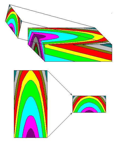
We can see that a down-plunge view can be easily obtained by simply compressing the map view by some factor. (Actually, looking a bit ahead, the compression factor is the sine of the plunge.) |
 |
There are two very nice features of down-plunge profiles:
|
 |
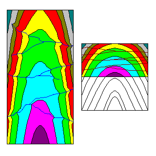
However, topography can complicate matters. The point in red at (x,y,z) would project at a different point on the profile plane than would a point at (x,y,0).
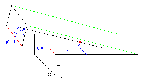
The diagram at left shows the coordinates we will use in developing formulas for down-plunge profiling. Obviously, x = x'. Distances at right angles to the trend of the fold project true. |
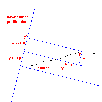 |
Here we develop a formula for taking topography into account. We can see that:
Obviously, y' = y sin p + z cos p. Thus, the coordinates of (x,y,z) in the profile plane are:
|
There are two ways to proceed from here. The formulas are easily computerized. We need two files: one with the geology of the map area and one with topography. Using the topography file, we find coordinates (x,y,z). We refer to the geology file to find the rock unit at (x,y), then project that data to (x',y').
If we already have data files, the computer approach is easy. For a very large or complex project it may pay to generate the files. But for a relatively small and simple structure it may still be faster to use a graphical approach.
Return to Course Syllabus
Return to Techniques Manual Index
Return to Professor Dutch's Home Page
Created 18 October 2000, Last Update 20 October 2000